Stages of Cadastral Map Development
As detailed elsewhere in the Gesher Galicia Map Room, the historical development process for surveying and mapping property boundaries and physical features of cities, towns, and villages in the former Austro-Hungarian kingdom of Galicia was one of progressive refinement, working through several stages of increasing geographical accuracy while gathering and recording essential administrative data for use in tax assessment. The draft and final cadastral maps which have survived in national archives since the end of the Austro-Hungarian Empire can be roughly grouped into three categories by their characteristics; the icons here correspond to those used in the cadastral maps section of this Map Room, which represents the type of property numbering which appears on maps in each category:
 preliminary field sketches
 intermediate indication sketches
 final-stage cadastral maps
Each of these types of cadastral maps can be useful in family history research, but they each function differently because the geographic and legal data is presented differently. This is important, because in most cases only a single cadastral map is available in archives for a town, and that map may be any one of the three types. In the sections below, we only briefly discuss the cadastral map development process, focusing most of our attention on how to recognize the different map types and then how to to use them in family history research. Throughout this page, numerous examples from the many historical cadastral maps in the Map Room provide a visual reference to train the eye to identify the key distinctive features of each map type.
This page is a component of the References section of the Map Room, and includes links to related articles there. Although much of the information presented here is derived empirically from the historical maps themselves, some of the background general and technical information is adapted and expanded from conference papers, journal articles, and websites which are included among many others on the Reference Literature page in this section; the specific references used here are listed at the bottom of this page.
You can read the subsections below in sequence, or click on a link here to go directly to that part of the page:
- The Map Development Process
- Features of Typical Cadastral Field Sketches
- Features of Typical Cadastral Indication Sketches
- Features of Typical Final-Stage Cadastral Maps
- Visually Identifying and Comparing Cadastral Map Types
- References Used on This Page
The Map Development Process
The Austrian land survey and cadastral mapping process was carefully defined and controlled by engineers, cartographers, inspectors, and administrators from the early 19th century. Only a simplified overview is given here, to allow us to concentrate on the three primary map types. In practice, more than three different maps of varying refinement may have been created for one town during a single survey period, but common characteristics among the variants allow us to group them into only three categories for historical family, demographic, and economic research. A few of the unusual variant maps are included among the examples in the sections below, for comparison.
Cadastral land surveys always began with establishment of the boundary of a town's cadastral area which separated the town from the cadastral areas of adjacent towns and villages. Ahead of the survey, landowners in the town were required to mark the corners of their properties with stones or wooden posts. The surveyor then began a set of field sketches (Feldskizzen in German), each sheet of which was a rough diagram made by hand of a section of the town including all land parcels and buildings plus both natural features such as creeks and manmade features such as roads. The first sketches were made on foot, on horseback, or from an elevated position such as a hill or tower, and were typically quite distorted, but were drawn at high scale (1 centimeter on the map corresponding to about 15 to 50 meters on the ground) so that essential physical details could be roughly captured and notes added. As the initial sketching proceeded, the surveyors noted the house numbers of property owners directly on the map, and for larger land parcels sometimes wrote the owners' names on the parcels as well. Even if field sketches poorly correspond to a town's historical geography, the direct correspondence of parcel labeling to family records is extremely valuable.
Progressive refinement in land measurements and remapping adjusted the representation of the town and its individual property boundaries, and added new details to the maps. The next stage of mapping, known in the imperial process as indication sketches (Indikationskizzen). These sketches can be difficult to read because they are typically crammed with information, and many are rather worn, evidence of their use both in the field and in the surveyors' and cartographers' offices. What makes these second-stage maps especially valuable is that each land or building parcel is annotated both with house numbers and with with tax parcel numbers, linking two types of historical family records directly on the map. Like the other types of maps described here, indication sketches were drawn at high scale and for almost all towns spanned several or many paper sheets.
When the land survey had been rectified through measurement, review, and inspection, a final-stage cadastral map (Katasterkarte) was prepared using the recently-invented lithography process to create one or more official imperial prints. Carefully drafted at a common scale of 1:2880 (in most cases), final-stage cadastral maps even nearly 200 years old are remarkably precise and accurate – so that occasionally an old Galician map is consulted to resolve property boundary concerns in Poland and Ukraine. However, for family historians there is an additional step of research which must be made in order to link ancestors to buildings and land on the map. Final-stage cadastral maps only show tax-identification numbers for building parcels (Bauparzellen) and land parcels (Grundparzellen) – not house numbers as are normally associated with vital records and most other family records. If the only map available for research is a historical final-stage cadastral map, the contemporary tax registers must also be located in archives to correlate property owners, house numbers, and building and land parcels.
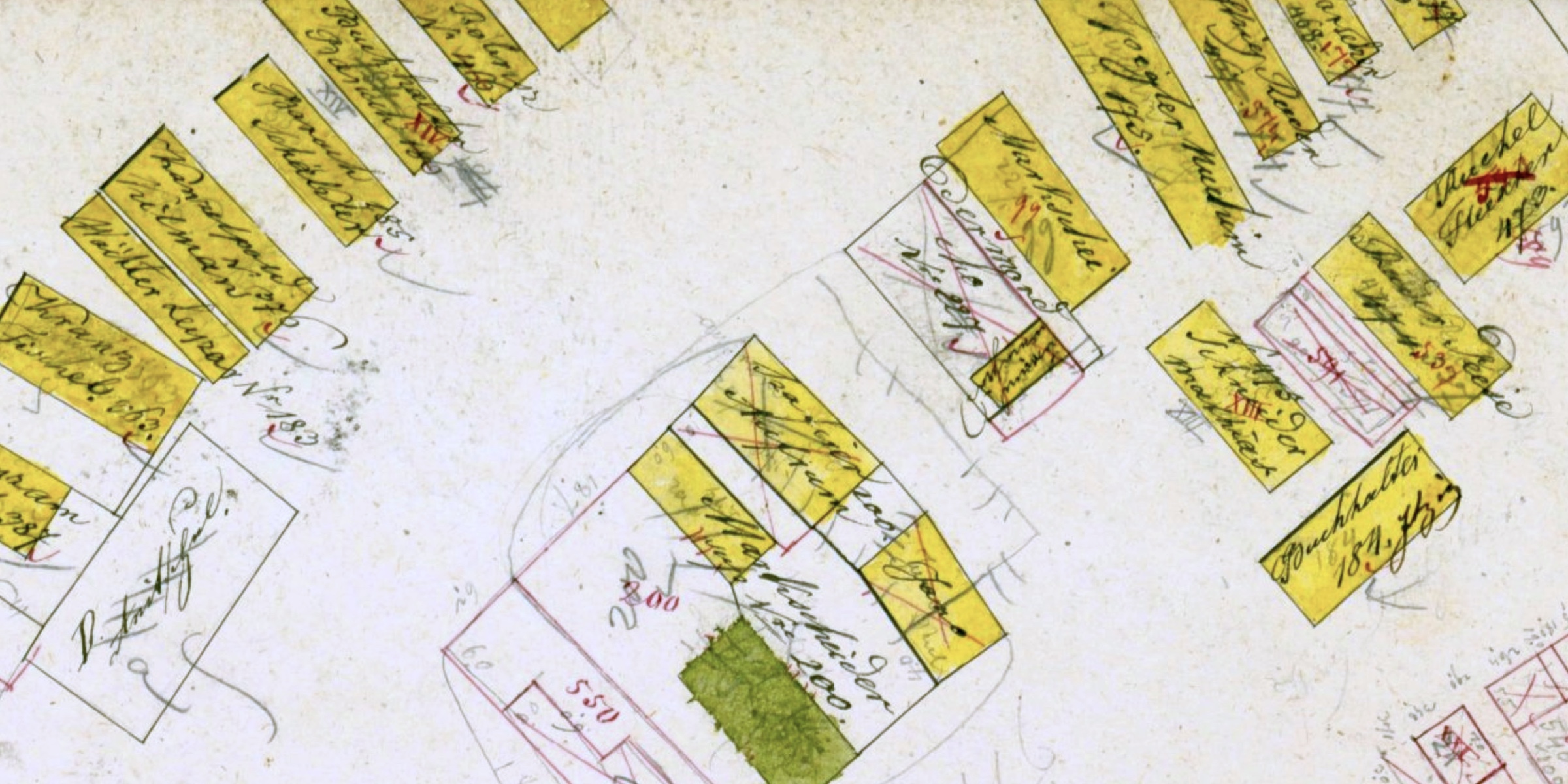
Settlements in Galicia did not remain static over time, and changes to properties and boundaries necessitated updates to the tax records and maps, especially in places which experienced fast growth and economic development. A cadastral maps of any type might be used as the basis for a working revision within the original survey or a later survey, and many of the cadastral maps which are preserved in archives show evidence of these revisions in redline markings representing new buildings or buildings lost and especially land parcel splits, extensions of community land to enlarge cemeteries, etc. These revision maps will be described and illustrated in a future article for this website, but several of the example maps shown on this page include redline markings.
Features of Typical Cadastral Field Sketches
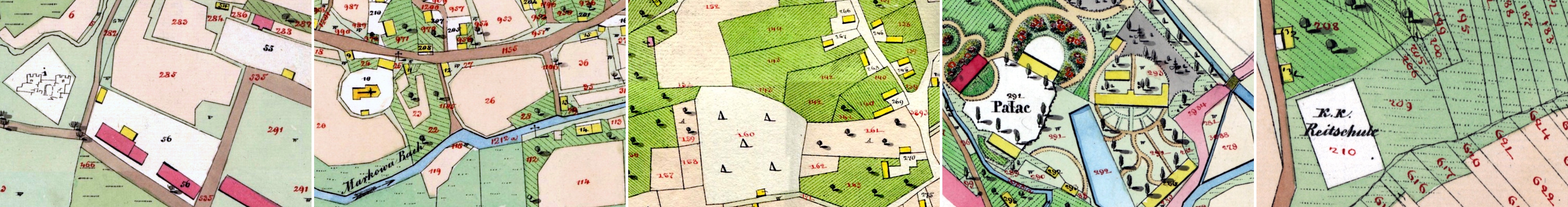
Preliminary field sketches reflect their technical purpose of identifying the relative locations of thousands of physical details to be measured and recorded for later, more accurate mapping. Field sketches were made by the surveyors as temporary tools for their own work only, and were never published; they include marks, symbols, and other details in the individual styles of each surveyor. For these reasons, field sketches are quite variable in their appearance, but common characteristics include:
- The sketches are drawn freehand in a rapid and rough style, sometimes without using even a straightedge or other tools to render the edges and corners of objects representing buildings rectangular. All annotations are made by hand, legible to the surveyors themselves but not always clearly to others.
- Property owners' house numbers and sometimes their names are written directly on land and building parcels.
- The use of house numbers for annotation means that only private properties are numbered; religious community buildings and land such as churches, synagogues, hospitals, and cemeteries do not have private owners tied to a "house", so no numbers.
- Religious community properties are typically marked with symbols or text designating the specific faith of the community. Thus, each church is regularly marked with a cross, and each Christian cemetery with one or more crosses or with the word Pfarre (parish), sometimes with the associated Christian denomination in German, Polish, or Latin (e.g. Pfarre ritus graeci) if there was more than one denomination of size in the settlement.
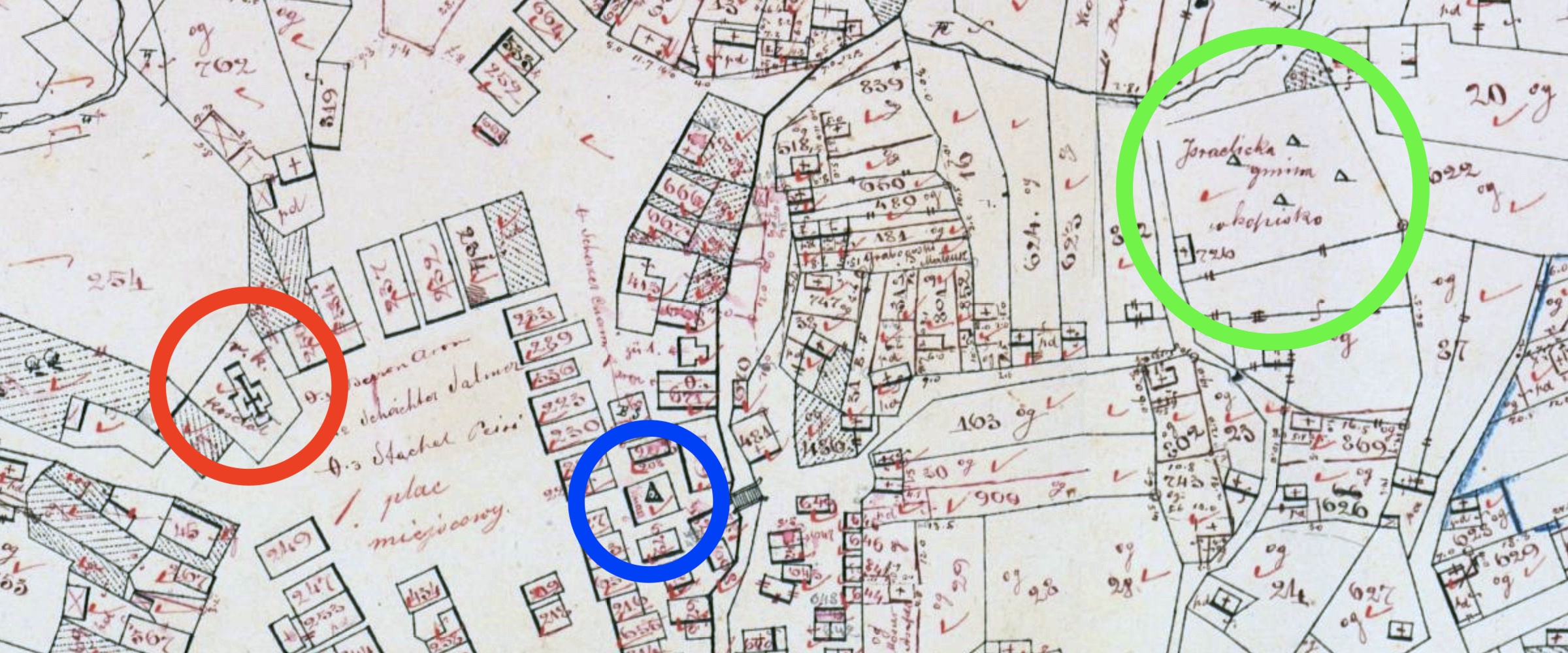
- Similarly, Jewish cemeteries were typically marked by one or more triangles schematically representing matzevot, sometimes rounded at the top, or with the words Juden Gemeinde, Izraeliten Gemeinde, Gmina Israelicka, or Jüdischer Beerdigungsplatz and occasionally Okopisko (Polish for a non-Christian burial ground); synagogues were marked with a similar triangle or with a Star of David (Magen David). These symbols matched the official Austrian cadastral map legends, except that there was no official symbol for synagogues. There was also no standard symbol for schools, hospitals, or community bath houses, so text in German or Polish was typically used. Note that only larger synagogues were marked; smaller shuls in private houses were not recorded (the residence was simply marked as a house with its house number).
- Civil community land is also annotated without house numbers, typically with the settlement name and the word Gemeinde in German or Gmina in Polish.
- The sketched parcel boundaries typically include chain anchor points and point numbers corresponding to measurement records in the initial survey; these chain point numbers clutter the sketch and are sometimes easily confused with house numbers.
- Dashed lines and numbered distances between physical features (often buildings but sometimes roads, wells, and other objects) also clutter the sketches and can also confuse interpretation of the sketches.
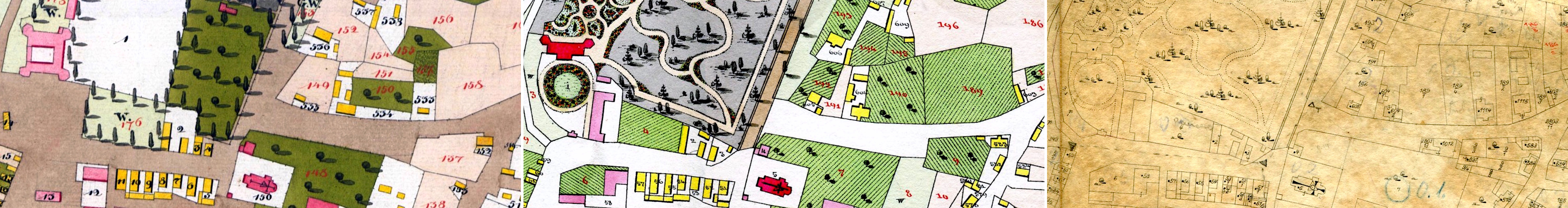
- Despite their informality, field sketches are typically hand-colored in a scheme corresponding to the official cadastral map legends, as another way to record land and building characteristics. Thus, wooden buildings are often colored in yellow and masonry buildings in red, grazing land in green, and more, to make clear to the surveyor and cartographer the property details which needed to be carried forward into the later maps.
- Because each field sketch was created and revised outside of well-controlled office or studio conditions, often they are stained, smudged, creased, torn, or otherwise damaged. While the damage sometimes impairs our ability to read some numbers and symbols, it also gives a palpable sense of the effort to create the sketch, and the passage of years since it was discarded when the next-stage maps were developed.
The field sketch examples in this section illustrate many of the characteristics described above; click on the images below to see greater detail.
Example maps shown here from left to right are of: Kozowa, Borki Małe, Mościska, Nienadowa, Żurów I. Theil.
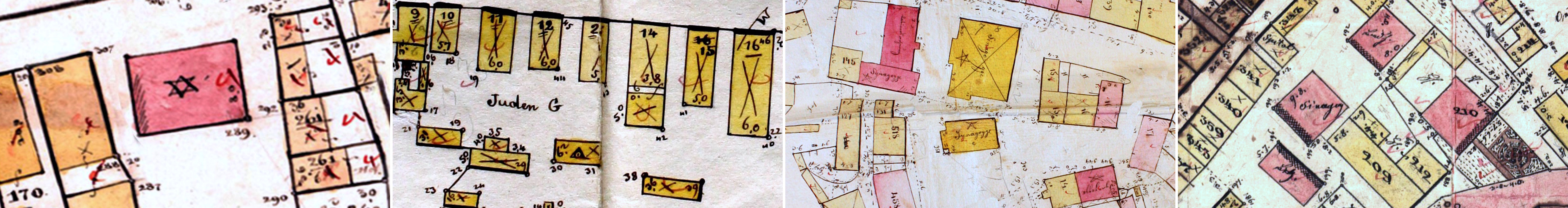
Sketches shown here from left to right are of: Sołotwina (with a star), Bukaczowce (with a triangle), Rohatyn (four synagogues with stars and labels), Nadwórna.
The Nadwórna sketch also shows other community buildings without house numbers: two ritual bath houses and a hospital.
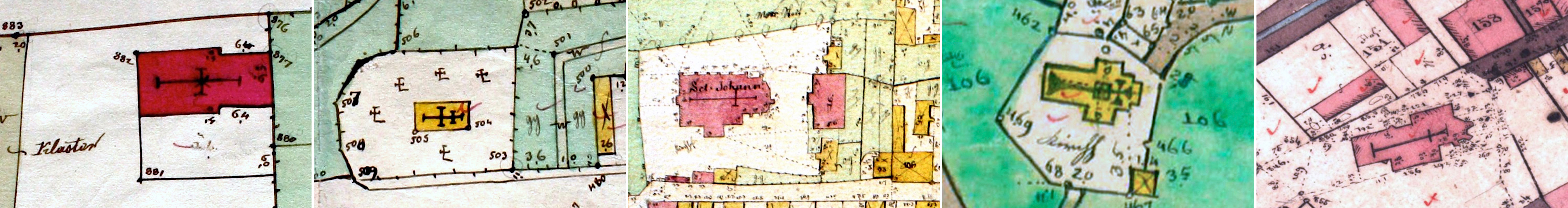
Features shown here from left to right are of: a Jewish cemetery and adjacent reserved land (Bukaczowce), a Christian cemetery (Świrz), land owned by the Greek Catholic community (Stryj), a town hall (Sołotwina), an imperial administration hospital and church (Rohatyn).
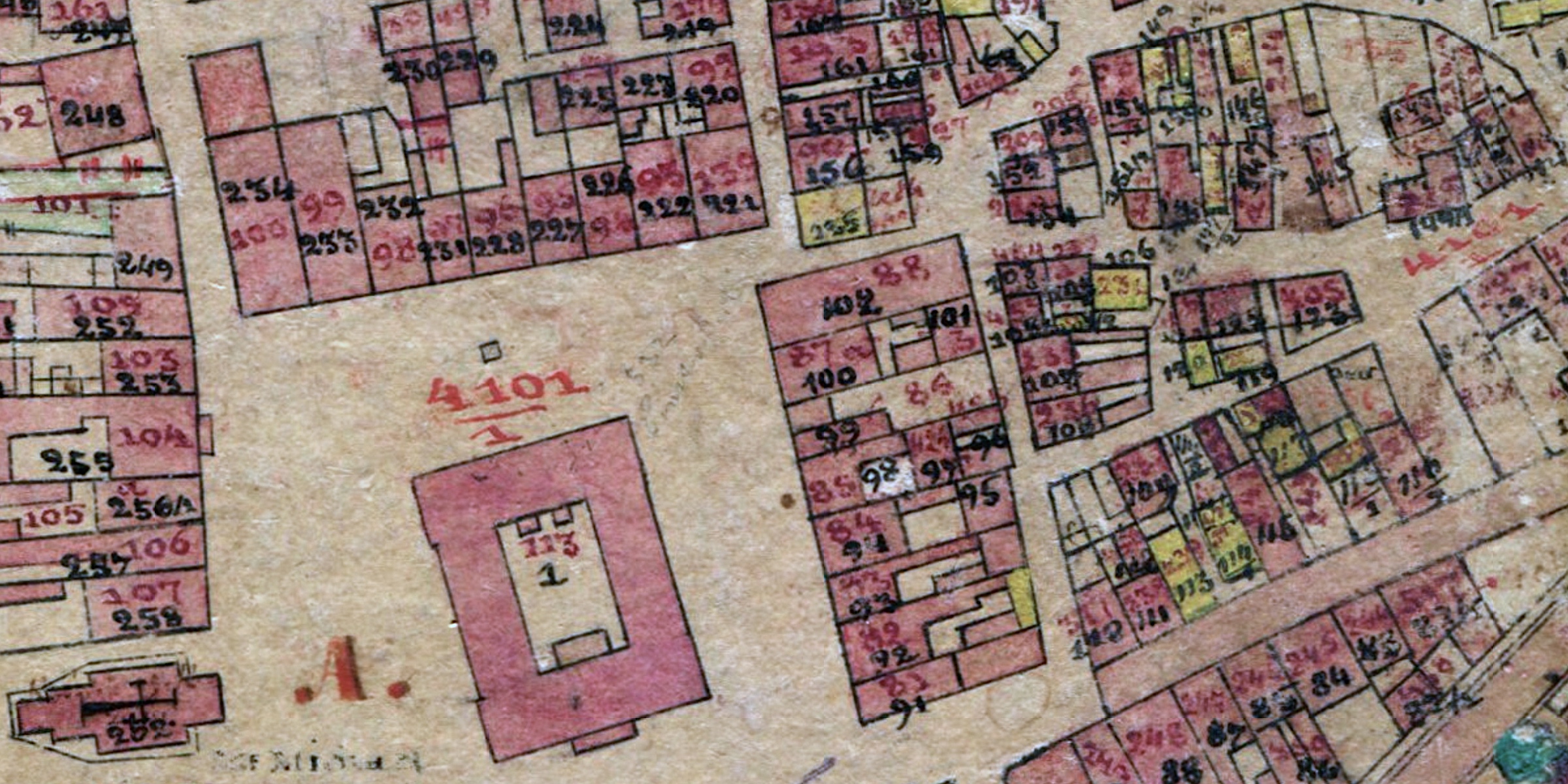
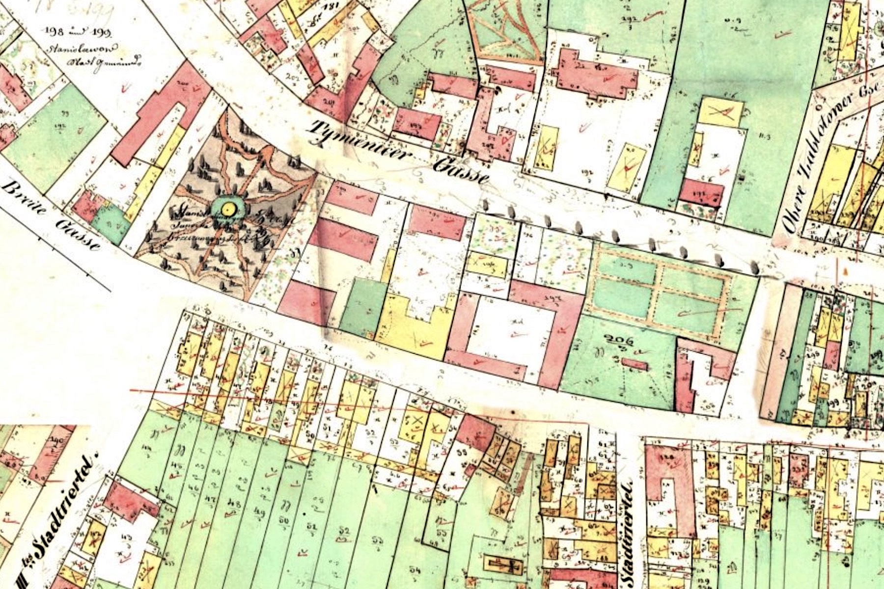
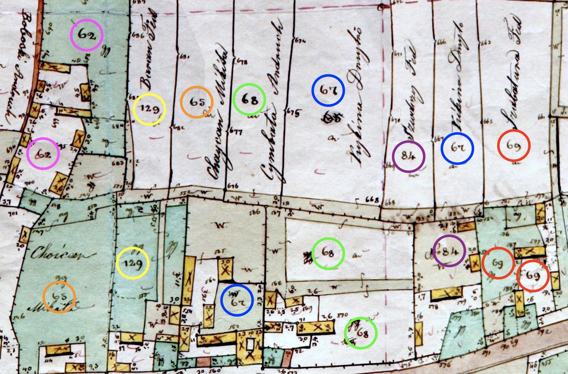
Features of Typical Cadastral Indication Sketches
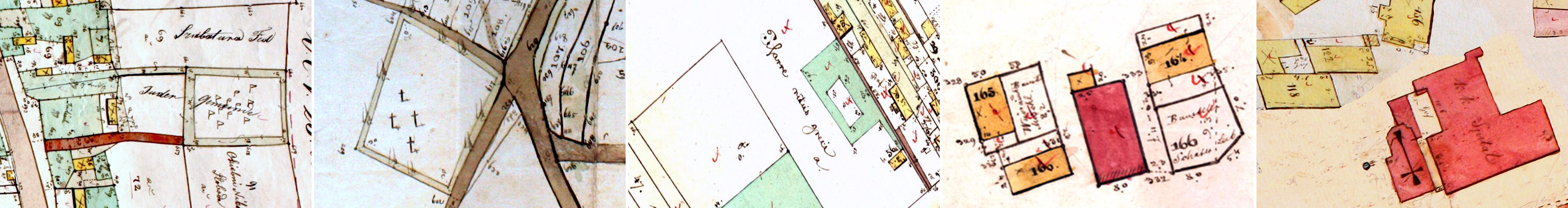
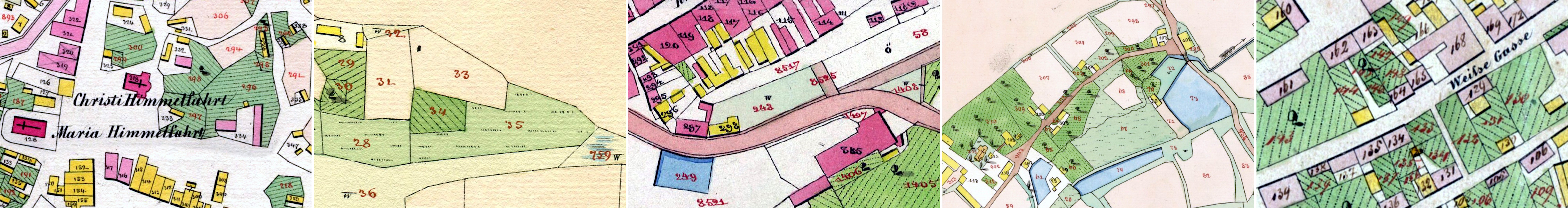
In appearance, indication sketches are something like a half-way stage between field sketches and final-stage cadastral maps: typically they are drawn more accurately than field sketches but not as regularly as the imperial prints, and indication sketches combine the two different property numbering schemes on the other maps, providing a direct graphical correlation between house numbers and parcel numbers. What appears at first glance to be a jumbled mess of numbers is actually a very useful historical research tool, and any genealogist who has access to an indication sketch for their town is very fortunate. Indication sketches vary by surveyor and cartographer, and by the phase of map development, but in general their characteristics include:
- Indication sketches vary considerably, but most are drawn by hand without templates and with no or limited drafting tools. Like field sketches, many indication sketches show significant signs of wear, suggesting that they also were carried into the field for review and revision by surveyors and inspectors. With the density of numbers and other marks, worn spots and heavily revised sections on the map sheets are sometimes very difficult to read.
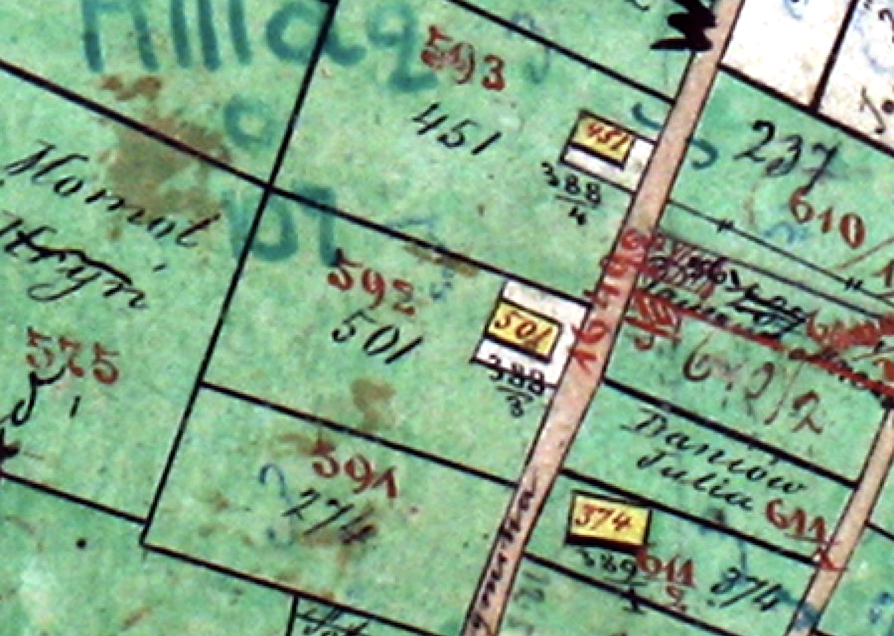
- Every private property parcel, whether building or land, is double-numbered; one number is the house number of the owner, the other number is the parcel's tax identification number. The color of the parcel number is the same as on final-stage cadastral maps: black for building parcels, and red for land parcels. In contrast, house numbers are written in the reverse color: red on building parcels and black on land parcels. This can be maddening at first (for researchers more than a hundred years after the map was created) but becomes clear with experience, and the scheme served the surveyors well while they were tracking hundreds or thousands of properties in a single town. See the images in this section for helpful examples.
- In some cases the house number is written in black and underlined for both buildings and land; this approach is generally easier to interpret.
- Community-owned properties (both religious and civil) lack house numbers, so they show only parcel numbers – and the single-numbering is also a clue to otherwise unmarked community buildings and land, for example synagogues and bathhouses, or plots owned for community income or future cemetery expansion.
- Many indication sketches still have property owners' names written on larger land parcels as a supplemental form of identification.
- Adherence to the official cadastral map legends is relatively high, but still with reduced or simplified symbols and sometimes with unofficial variants.
- There are often exceptions to these typical characteristics, either on a few individual parcels or at town centers vs. suburban areas. One common exception was the labeling of the parcel owner's name instead of the house number; another was the irregular coloring of house and parcel numbers (which can quickly lead to confusion). It appears that the surveyors were more concerned to make the sketches useful in their own work than to follow rules.
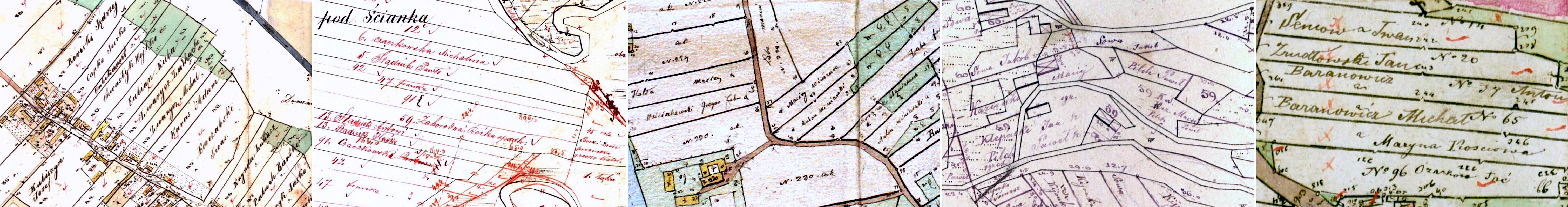
The indication sketch examples in this section illustrate many of the characteristics described above; click on the images below to see greater detail.
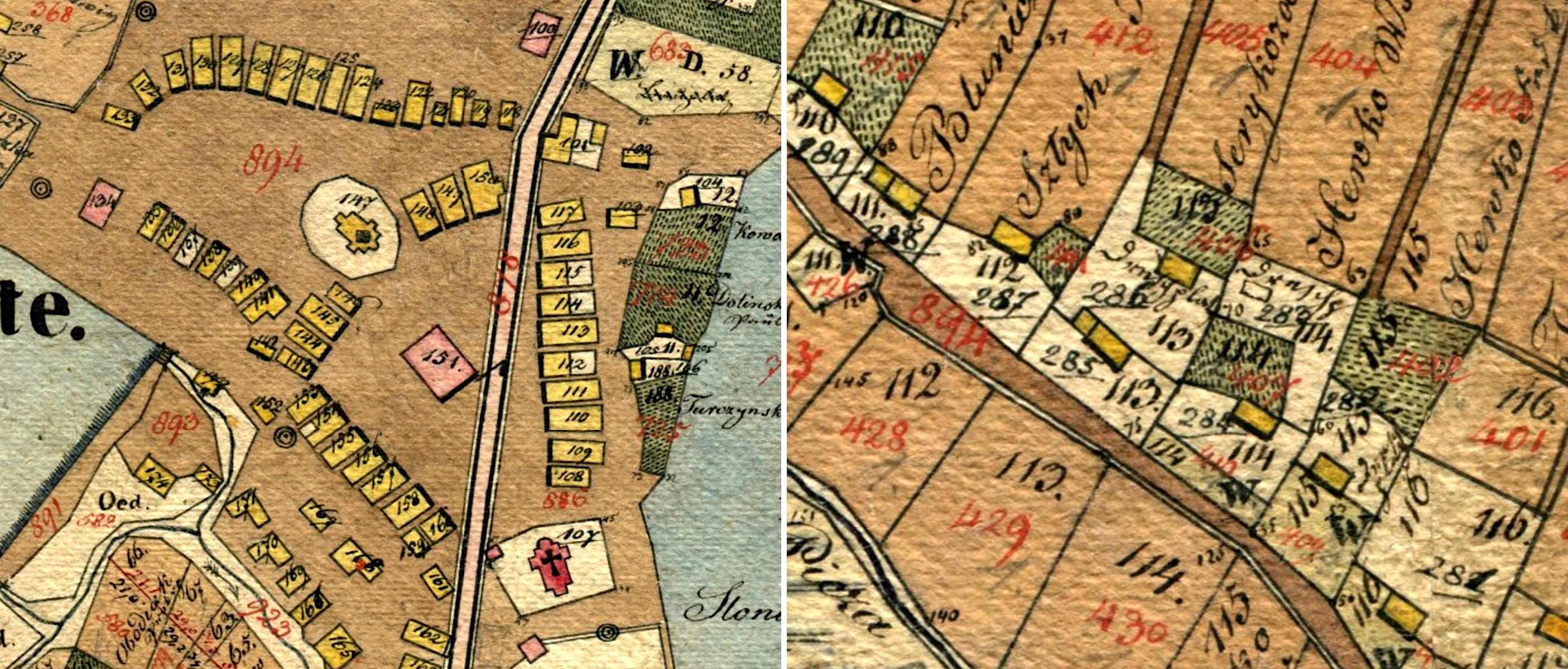
Normal variations in the double-numbering scheme are shown here from left to right: the standard scheme with house numbers in reverse color to the parcel numbers (Skała); the standard scheme again with only land parcels shown on this village map (Czortowiec); the standard scheme again with only building parcels shown on this market square map (Tarnopol); an alternate house numbering style with black numbers and an underline (also Tarnopol); another alternate style with underlined black house numbers only on building parcels (Janów.
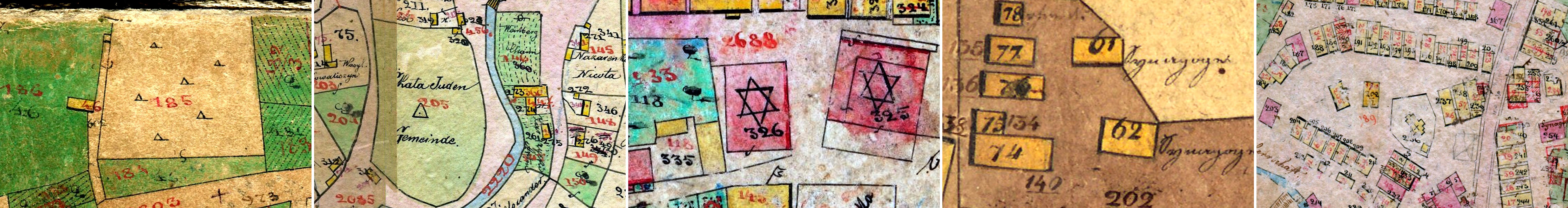
Excerpts shown here from left to right are of cemeteries (Grzymałów and Skała) and synagogues (Bełz, Janów, and Tłuste). On the Tłuste map, one can see other community buildings without house numbers such as a church (building parcel number 236) and a Catholic community stable (building parcel number 203).
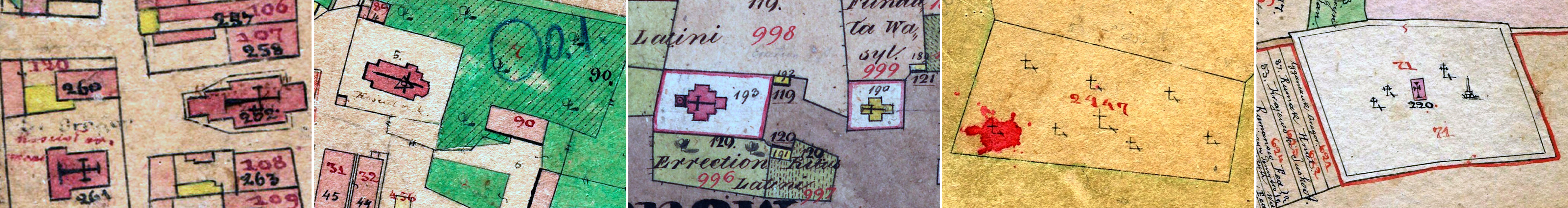
Excerpts shown here from left to right are of churches (Brzeżany, Grzymałów, and Janów) and cemeteries (Grzymałów again plus Skała).
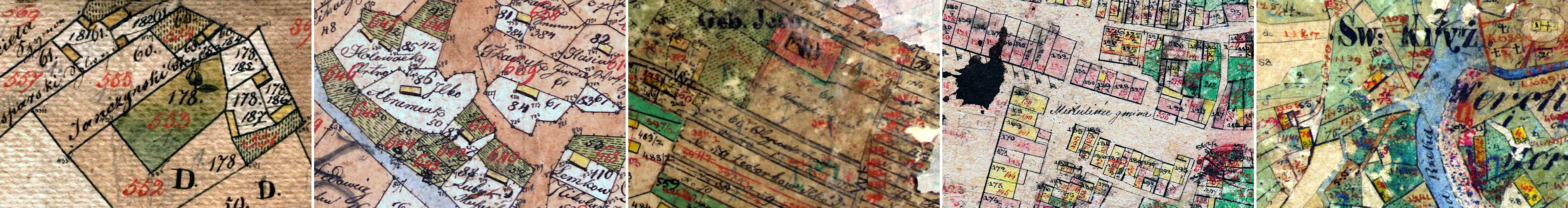
Example maps shown here from left to right are of: Tłuste (building parcel numbers are underlined instead of black house numbers), Czortowiec (both house numbers and building parcel numbers are black, with no underlines, making distinction difficult), Lachowce (significant wear obliterates some parcel numbering), Mikulińce (stains and smudges make reading some numbers impossible), Żydowskie (ink bleed and wear obscure some numbers).
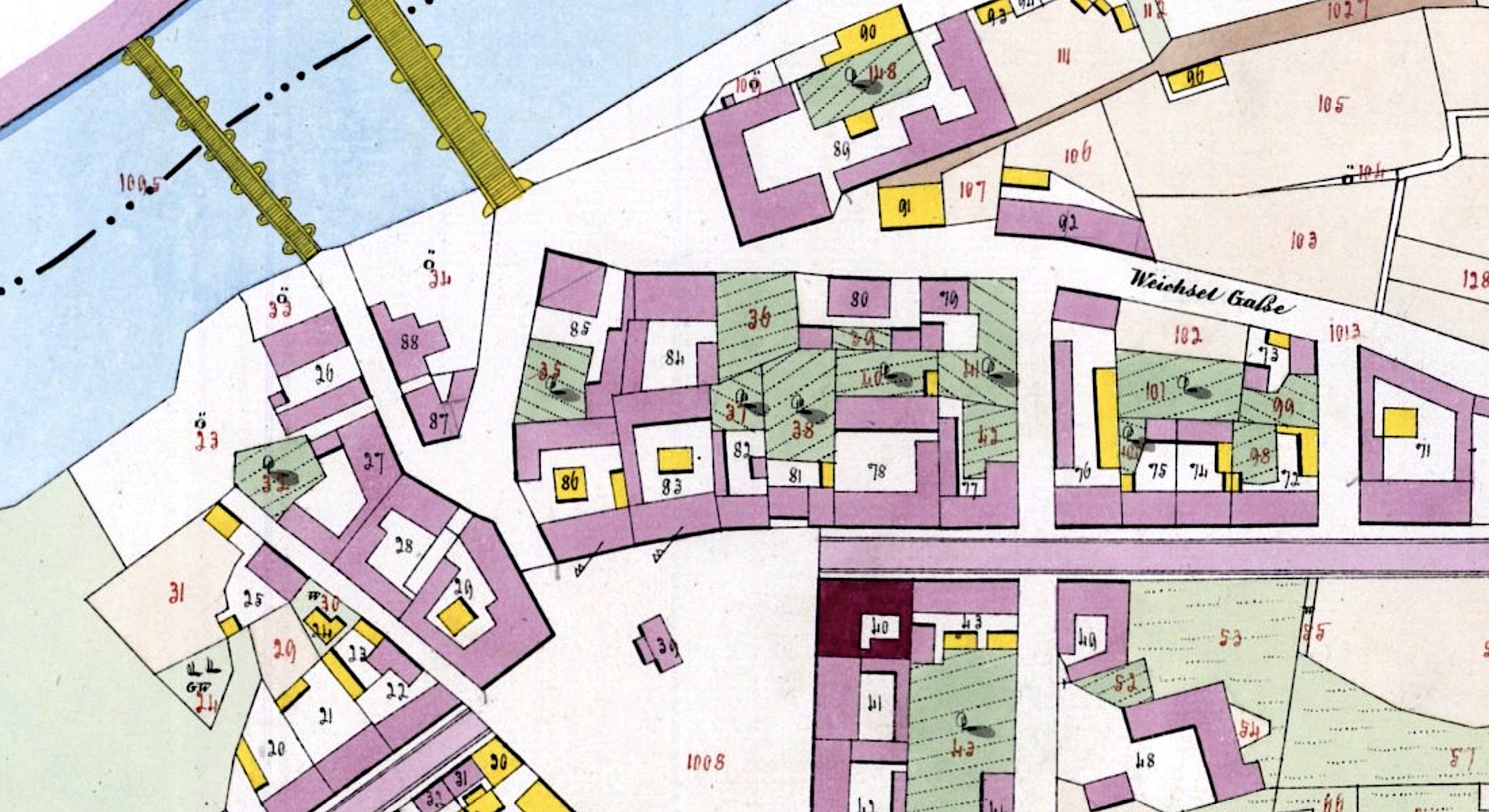
Features of Typical Final-Stage Cadastral Maps
Lithographed and colored final-stage cadastral maps stand out for their beauty and clarity. While field sketches and indication sketches had no official purpose once the final-stage map was drafted, and so were discarded or kept only for local use, in most cases surviving imperial prints were initially well preserved in Vienna and later in the state archives of the successor countries as important legal documents for the many decades since their creation. As is described elsewhere in the Map Room, these outstanding maps and their associated property registers were the goal of the immense scientific and administrative survey and map initiative of the Habsburg Monarchy and its later empires.
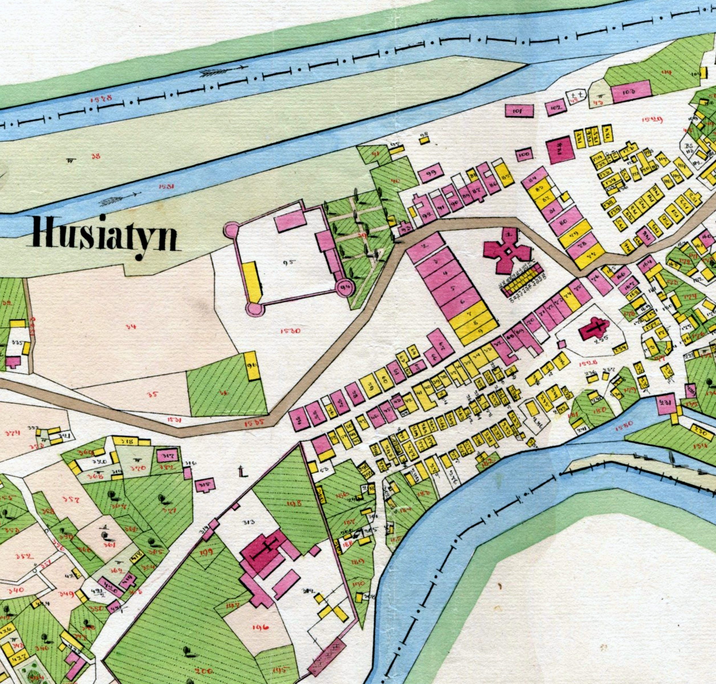
Final-stage cadastral maps show far less deviation from drafting standards and variation from map to map than the earlier-stage sketches. Rather, a slow evolution in graphical style is seen over the span of nearly a hundred years as drafting techniques were refined and the imperatives of speed and clarity drove both simplification and standardization. Some of the common and evolving features of these maps include:
- Historical final-stage cadastral maps are both accurate (in absolute geographical position, tied to the formal Austrian military and civil triangulation nets) and precise (in the dimensions of natural and man-made features, as well as the relative positions of features). The survey engineering, the cartographic process, and the lithographic printing process, all combine to make a document which very closely resembled the two-dimensional reality of settlements.
- The lithographed cadastral maps consistently conform to the cadastral map legends (i.e. line, symbol, and color standards) in effect at the time of their creation. Because the official legends did not change significantly from the 1820s to the end of the Empire, interpretation of cadastral maps from any decade is fairly simple. Similarly, familiarity with Galician cadastral maps transfers readily to final-stage maps of any other crown land in the Empire, including Hungary, Bohemia, Moravia, etc.
- Only building parcel numbers (in black color) and land parcel numbers (in red color) appear on the maps; no house numbers are included on the original prints. For family history research, this means that contemporary property registers (either building parcel registers or alphabetical property owner registers) must be used to correlate the building parcel numbers on the map to house numbers in other historical records.
- Many of the informal symbols used on the earlier sketches for features which do not appear on the official cadastral map legends are absent on these final-stage maps. A key example is the triangle or star sometimes applied to synagogues on the sketches; most synagogues on the final lithographed maps are annotated only with a building parcel number (whereas churches are almost always marked with symbolic crosses). This rule is not universal, however, and unofficial symbols or labels still appear on a small number of Galician final-stage cadastral maps.
- Over time, the color palette of the maps gradually shifted from darker to lighter shades of the same colors and to more spare use of color overall. This shift improved the perception and legibility of symbols though greater contrast with black lines and annotations, while retaining consistent interpretation of the symbol hues. Age has also darkened the paper underneath the applied colors on many of the oldest map sheets, but the two effects can be separated through image adjustments in the digital versions.
- Sometimes lithographed copies of final-stage cadastral maps were used to prepare revisions (updated) for later editions, documenting buildings added or lost since the original survey, and changes to land parcels. The redline revisions can confuse interpretation by modern researchers a century later, and will be described and explained in a separate reference article on the Map Room. Note that a majority of the surviving final-stage cadastral maps for settlements in eastern Galicia (today western Ukraine) are revision maps.
The final-stage cadastral map examples in this section illustrate the characteristics described above; click on the images below to see greater detail.
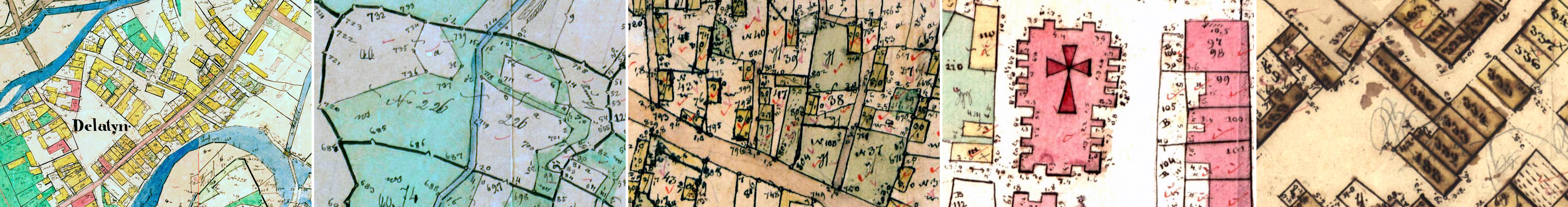
Example maps shown here from left to right are of: Białoboki, Gać, Czortków, Brzozów, Szechynie.
Example maps shown here from left to right are of: Jagielnica, Romanowe Sioło, Jarosław, Siennów, Bochnia.
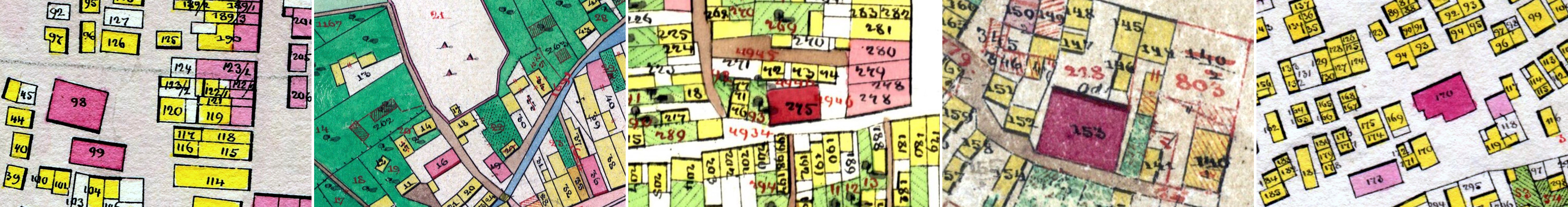
Example maps shown here from left to right are of: Zbaraż, Chyrów, Stary Sambor, Brzesko, Czortków.
Example maps shown here from left to right are of: Sambor, Dobromil, Komarno, Jaworów, Żółkiew.
Example maps shown here from left to right are from 1828, 1861, and ca. 1900.
Visually Identifying and Comparing Cadastral Map Types
For family historians using cadastral maps of Galicia in their research, a necessary first step is to identify the type of map(s) available for a particular city, town, or village which features in their ancestors' lives, so that the numbers on buildings and land can be correctly interpreted. Maps for Galician settlements which appear in the cadastral section of the Map Room have been categorized by type and labeled using the symbols which appear above on this page ( ![]()
![]()
![]() ). However, even we make mistakes, and the type of map should be verified by careful scrutiny and interpretation to prevent misunderstanding. Many researchers will encounter cadastral sketches and maps which are not included in the Map Room; the map characteristics described and illustrated above plus the analysis methods outlined in this section can aid anyone who acquires a cadastral map of unknown type in their study.
). However, even we make mistakes, and the type of map should be verified by careful scrutiny and interpretation to prevent misunderstanding. Many researchers will encounter cadastral sketches and maps which are not included in the Map Room; the map characteristics described and illustrated above plus the analysis methods outlined in this section can aid anyone who acquires a cadastral map of unknown type in their study.
Drafting style and line quality are helpful indicators of map development stage, but a significant portion of the surviving stock of historical cadastral maps in archives in the former region of Galicia is composed of revision maps, which overlay new survey data and annotations onto prior map editions or vice versa. Thus in some cases it is possible to find only house numbers on a precisely-drafted final-stage cadastral map, or only parcel numbers on a rough sketch, and no other cadastral map available for the place.
Indication sketches are usually unambiguous due to their double-numbering scheme which annotates every property with both the tax parcel number and the house number of the property owner. Although the number coloring scheme used on a particular map does not always follow the historical standard, usually it is possible to identify even the owner's house number in ambiguously-colored building numbers. Then the descriptive information included in the indication sketch section above may be applied in interpreting the map.
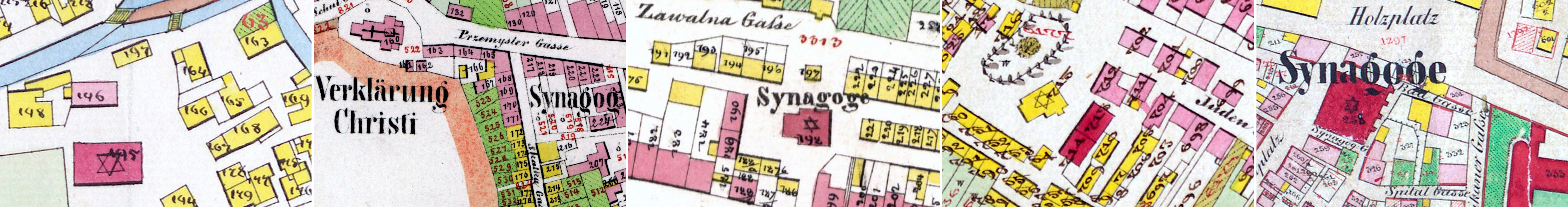
Recognizable civil and religious community land and especially buildings are perhaps the best key to the property numbering on a particular historical cadastral map of any type. Unlike individual private property owners, communities did not live in a house (i.e. a residence), so in most cases no house number should appear on community buildings or land. The majority population in most historical Galician settlements was Christian, so any place larger than a small village was likely to have a church in the 19th century, and churches were almost always marked with a symbolic cross on cadastral sketches and maps. The first and usually quickest way to identify the map type and numbering is to find one or more churches and check their numbering: if there is no number on or beside a church, then the map shows house numbers only and is a field sketch; if there is a number on or beside a church, then the map shows parcel numbers and is an indication sketch or a late-stage cadastral map. There are rare exceptions to this rule, for example when a church official lived in a house provided by the parish on the building parcel assigned to the church; this type of recording is irregular and rarely seen.
Jewish community buildings may be used similarly for map type identification, though Jewish communities were often smaller than their Christian counterparts (so few or no prominent Jewish buildings may have existed) and synagogues were often not identified with symbols or labels. Civil community buildings such as town halls can sometimes be used for map type identification as well, but sometimes community leaders were housed in these buildings so that they were classified as residences and carried house numbers.
Community-owned land parcels can also help to identify a map type, again because no house number would normally be associated with the land. Jewish and Christian cemeteries on field sketches are usually marked with symbols (triangles and crosses, respectively) or with labels but without numbers. On indication sketches and final-stage maps, the land parcel number of each cemetery is normally indicated in red color, without a house number. Buildings at cemeteries used to prepare the dead for burial should carry building parcel numbers but not house numbers. Civil community land such as parcels defined as shared pastures for grazing (Gemeinde Weiden, labeled G.W. or GW on maps) are difficult to identify on early-stage maps because not all land parcels were reliably labeled on the early maps.
There are many variant and even "odd" maps in the Gesher Galicia cadastral map collection, and probably many more surprises waiting for us in the archives. This page should help to identify and interpret most historical cadastral maps of Galicia which genealogists and others will encounter in their research.
References Used on This Page
The Reference Literature page in this section provides a large number of conference papers, journal articles, books, and other texts relevant to the history of Habsburg, Austrian, and Austro-Hungarian cadastral survey and mapping practices. The following references were especially useful in assembling this page:
- Susanne Fuhrmann, Digitale Historische Geobasisdaten im Bundesamt für Eich- und Vermessungswesen (BEV) Die Urmappe des Franziszeischen Kataster (Digital historical geobase data in the Federal Office for Calibration and Surveying (BEV): The original documents of the Franciscan Cadastre), BEV, 2007.
- Brian J. Lenius, "House Numbers and House Names in the Austrian Empire Using Examples and Documents from Galicia"; East European Genealogist, Spring 2016, Volume 24, No. 3.
- Gabriele Wessely, "An Overview of the Cadastral Surveys in the Austrian Empire"; East European Genealogist, Spring 2005, Volume 13, No. 3.
- Brian J. Lenius, "Cadastral Land Surveys and Maps for Galicia, Austria"; East European Genealogist, Spring 2005, Volume 13, No. 3.