The Gesher Galicia Map Room
Digital images of maps covering the historic region of Galicia in our inventory are acquired with permission from archives, libraries, and both public and private collections in modern Poland, Ukraine, Austria, Germany, Israel, and the United States. For more information, contact the Gesher Galicia Digital Maps Manager at: maps@geshergalicia.org.
What's New
| 08 Apr: | Krosno Cadastral Map 1851 |
| 08 Mar: | Pruchnik Cadastral Map 1852 |
| 11 Feb: | Pniów Indication Sketch 1847 |
Map Sections
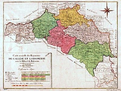
Regional Maps
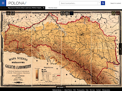
This section gives a colorful introduction to Galicia and its place in the Austro-Hungarian Empire. The regional maps span historical time from the years immediately after the imperial partition of Poland which created Galicia, to the Great War which tore apart empires and brought Galicia into the Second Polish Republic, and then to the start of World War II which resulted in the division of former Galicia between Poland and Ukraine. Many of the maps focus on district boundaries within Galicia, important to records research by genealogists. Other maps document transportation and communication routes, statistics of regional production, and of course features of military interest.

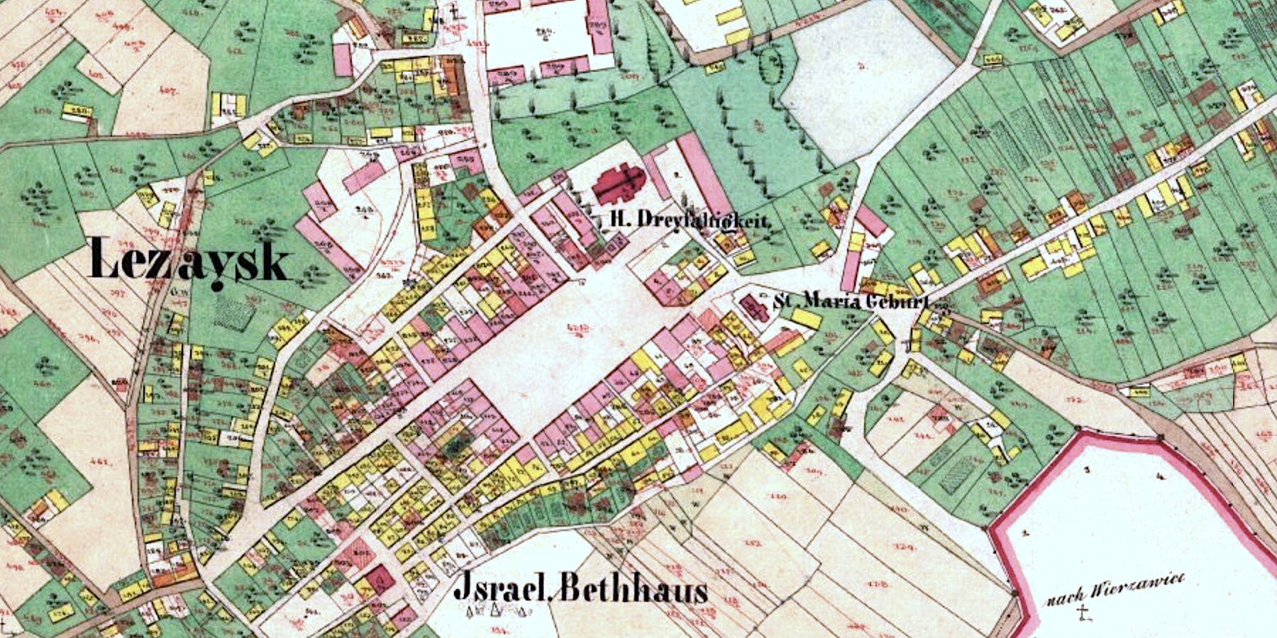
Cadastral Maps
This core section of the collection presents historical cadastral maps – highly detailed graphical property records – which in many cases can be used by genealogists to determine precisely where their ancestors lived in Galicia under the Austrian Empire, and by historians of all types to study the demographics and economics of settlements, the proximity of civil and religious community buildings to ethnic neighborhoods, the siting and evolution of burial grounds, and more. The accuracy and feature detail of historical cadastral maps add important spatial dimensions to the time element of family history research. The original paper maps are very large, produced on many separate sheets; for this digital presentation, we assemble the sheets into a huge single image in the viewer to simplify study.
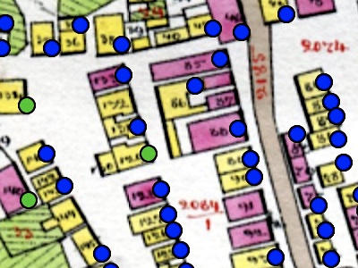
Data Maps
A special project coordinated by Gesher Galicia to bring together indexed family history records data with historical cadastral maps of a town, presenting the data in an interactive browsable and searchable format. Where the available data is sufficient, clicking on individual houses can show a long series of marriages, births, deaths, and ownership tied to that location. Data collection and assembly is organized by town research leaders with support from Gesher Galicia.
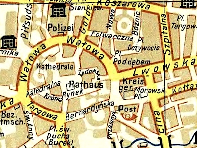
Street Maps and General City Plans
This section presents historical street maps of major cities in Galicia and Bukovina which can provide an important bridge in family history studies between cadastral maps and the modern era, specifically in locating where family residences and business were located during the "Austrian era" and the interwar period. The transition to street addresses (with a number and the name of a street or square) occurred much earlier in cities than in smaller settlements, which makes these street maps valuable as a locator of family neighborhoods and sometimes specific buildings.
Special Maps
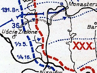
In this section we gather a wide variety of unusual historical maps of Galicia, each of which studies and documents a perspective other than the more typical purposes of the street maps and general plans in the section above. Included are maps with a scientific focus, others which document the ethnographic makeup of the kingdom, maps which pinpoint colonies in Galicia formed and settled by foreign nationals, WWI battle studies, maps which document aspects and events of the Holocaust in former Galicia, and personal memory maps of prewar towns drawn by Jewish émigrés and survivors after the war.
Reference Sections
Historical Map References, Tools, and other Information
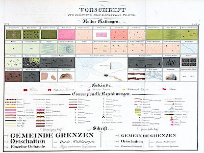
An overview page with links to articles on a variety of topics related to historical maps, especially cadastral maps of towns in the former Kingdom of Galicia. Key topics include a multi-part introduction to Galician cadastral maps, detailed studies of selected cadastral map features, a survey of historical map legends (to explain the symbols used on cadastral maps), and a summary of Gesher Galicia's technical work to assemble and present the historical maps online for all to use.
Sources of Historical Maps and Other Information
A page listing and linking a wide variety of archive and internet resources which can be used to locate historical maps related to the former Kingdom of Galicia. The map sources range from official national or university archives and libraries to the collections of NGOs and private individuals and the organized or limited postings of genealogical organizations with interest in the region. Many of the sources listed provide online tools for viewing and sometimes for downloading digitized versions of the maps. Most of the sources have been used to search and acquire maps in digital form for presentation in this Map Room.